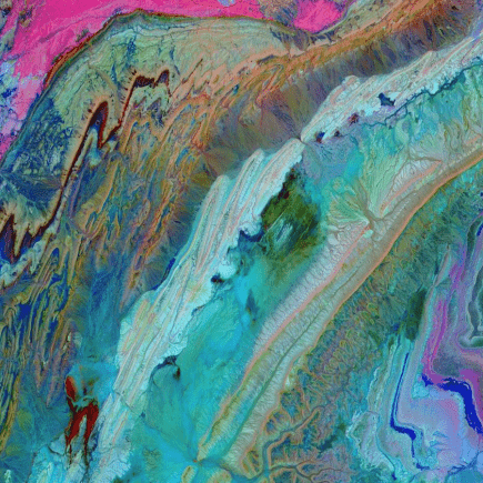
On December 30, 2019, in honor of celebrating the end of a decade, the National Aeronautics and Space Administration released captivating images of Morocco’s Anti-Atlas Mountains. The colorful images included rock formations and foldings that run through Northern Africa. According to NASA, the mountains are millions of years old They were likely formed after the collision of African and Eurasian tectonic plates (80 million years ago).
“The limestone, sandstone, claystone and gypsum layers that formed the ocean bed were folded and crumpled to create the Anti-Atlas Mountains,” NASA reported to FOX news. To illustrate the Atlas’ rocky outcrops and lunar landscapes, near-infrared and short-wavelength infrared bands were used. The advanced technology was able to highlight rock foldings and different rock types.
The Anti Atlas Mountains are not easy places for settling however there are a few Berber (Amazigh) villages in the area. The mountains run from the Atlantic Ocean in southwest Morocco, extend towards the north of Ouarzazate, touch Tafilalt in the east, and border the Sahara Desert in the south.


